Local History
 On the north shore of the Washita arm of Lake Texoma in northwestern Bryan County lies the partially restored ruins of old Fort Washita. The frontier military post was built on a site selected and named by Gen. Zachary Taylor, who became the first post commander in 1843, and later president of the United States. The fort was garrisoned by United States troops until May 1, 1861, when it was abandoned to Confederate forces. Although Fort Washita was not used as a military establishment after the Civil War, the post office continued in operation until 1880. The site is kept open to the public by the Oklahoma Historical Society.
Bronze plaques mark several of the watering stops in the Lake Texoma area that were used to change horses or to pick up mail when the 2,796-mile-long Overland Butterfield Stagecoach Line was in existence.
The Chisholm and Shawnee trails, over which cattle were driven through Texas and Oklahoma to the markets in Kansas, also crossed this area. Just below Denison Dam is the old Colbert's crossing, which later became a ferry, and later yet, a toll bridge. It was an early day crossing for Indians, military expeditions, outlaw gangs, Texas road freights, and prairie schooners.
In Denison, a President of the United States was born in a white gabled two-story house by the side of a railroad track on October 14,1890. He was Dwight D. Eisenhower whose birthplace has been restored by the Texas Parks and Wildlife Departments.
In the Preston Bend area, beside the relocated Preston Cemetery, a granite marker commemorates the Indian Trading Post established in 1837 by Holland Coffee and is now submerged by Lake Texoma.
Tishomingo boasts the last capitol of the old Chickasaw Nation, a native granite building of Victorian architecture standing on top of a hill Adjacent to the capitol is the Chickasaw Council House Museum dating for 1856. Close at hand are the ruins of the Chickasaw Male Academy established in 1850. Also located near Tishomingo at Emet, Oklahoma is the "Chickasaw White House". It was once considered a mansion on the frontier. It was home to Chickasaw Governor Douglas Hancock Johnston and his family from 1898 to 1971.
At the west edge of Kingston is the Camp Leavenworth marker erected in memory of the ill-fated expedition of 1834 made of the Dragoon Regiment. The site of Camp Leavenworth (probably about 4 miles south of the marker is now inundated by Lake Texoma).
In Durant, first settled by the Choctaw family of that name in 1870, you may see some of the early day galleried residences with high ceilings and big windows which reflect the influence of the old southern plantation owners' townhouses. These are characteristics of many fine old southern home, which settlers built up and down the valley.
Dam History and Development
The lake has crested the dam's spillway at a height of 640 feet (195.07 m) five times: once in 1957, again in 1990, again on July 7, 2007, and most recently in May 2015, and again in June 2015.
Lake Texoma Summary and Description
U.S. Army Corps of Engineers Reservoir: The U.S. Army Corps of Engineers invites you to visit Lake Texoma, the largest lake in capacity in the Tulsa District and the twelfth largest in the United States. It is also one of the most popular Federal recreation facilities in the country, with more than 6 million visitors annually. In 1999 Texoma ranked first among Corps of Engineers lake projects nationwide, with visitors spending over 90 million hours at the lake.
Authorization: Flood Control Act approved June 28, 1938, Project Document HD 541, 75th Congress, 3d Session (flood control and power); Public Law 868, 76th Congress, 3d Session, approved October 17, 1940 (improving navigation, regulating flow of Red River, controlling floods, and other beneficial uses); Public Law 454, 78th Congress, 2d Session, approved September 30, 1944 (impoundment designated as Lake Texoma); Public Law 273, 83rd Congress, 1st Session, approved August 14, 1953 (Denison water supply storage); Public Law 164, 84th Congress, 1st Session, approved July 15, 1955 (construction of Willis Site Bridge); Public Law 146, 85th Congress, 1st Session, approved August 14, 1957, Project Document HD 541, 75th Congress, 3d Session, (Sherman water supply); Public Law 282, 91st Congress, 1st Session, approved July 19, 1970 (water supply dam on Big Mineral Arm); Public Law 662, 99th Congress, 2d Session, approved November 17, 1986 (added recreation as a project purpose and authorized reallocation of additional storage for water supply).
Location: On the Red River at river mile 725.9, 5 miles northwest of Denison in Grayson County, Texas.
Status: Completed
Purpose: Flood control, water supply, hydroelectric power, regulation of Red River flows, improvement of navigation, and recreation.
History of Construction: Construction began in August 1939 and was completed in February 1944. The project was first available to operate for full flood control without any restrictions in January 1944. The first hydroelectric turbine was placed on line in March 1945 and the second in September 1949. Construction of a highway bridge across Lake Texoma at the Willis Ferry site started April 24, 1958 and was completed October 30, 1960. The 5,426-foot-long bridge replaces a former crossing south of Woodville, Oklahoma, on Oklahoma State Highway 99 and Texas State Highway 91. The roadway surface is about 37 feet above the top of the power pool.
Type of Structure: The structure is a rolled earthfill embankment with a rock- protected upstream slope. The main embankment is 15,200 feet long. The maximum height of the structures is 165 feet above the streambed. A rolled earthfill dike 5,870 feet long and 15 feet high is located in the vicinity of Platter, Oklahoma. The Cumberland levee is 23,480 feet long with a crest elevation of 647.0. Highway 75A crosses the top of the dam.
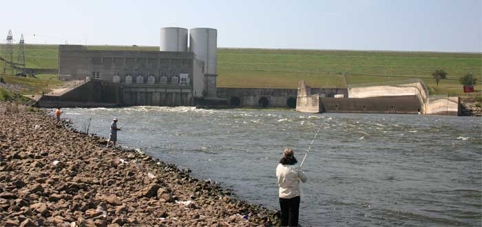
Spillway & Outlet Works: The uncontrolled spillway is a concrete, gravity, chute-type structure, 2,000 feet long, located in a saddle on the right bank. Spillway capacity at maximum pool (elevation 666.4) is 1,050,000 cfs. The outlet works consist of three 20-foot-diameter, concrete conduits through the embankment equipped with six 9- by 19-foot vertical lift gates and one emergency gate. Capacity of the outlet works is 67,500 cfs at the top of the flood control pool and 60,120 cfs at the top of the power pool. Limiting channel capacity below Denison Dam is about 60,000 cfs.
Hydrologic Data: The estimated peak discharge for the May through June 1908 flood was 470,000 cfs. The volume was 8,517,000 acre-feet which is equivalent to 4.73 inches of runoff. The peak inflow for the May 1990 flood was 300,000 cfs with a volume of 5,087,000 acre-feet. The peak inflow for the May through June 1987 flood was 315,000 cfs with a volume of 2,879,000 acre-feet. The total volume of inflow for the 1957 flood was 8,364,000 acre-feet.
Source: Corps Lake Texoma Office web site. Click here
Links
Lake Texoma Points of Interest (POI’s) for new and different experiences around the lake:
- Eisenhower State Park
- Lake Texoma State Park
- Eisenhower Birthplace
- Harber Wildlife Museum
- Red River Railroad Museum
- Morton Museum of Cooke County
- Museum of Southern Oklahoma


